Phnum Kravanh District (Phnum Kravanh)
Phnum Kravanh district (ស្រុកភ្នំក្រវាញ) is a district in Pursat province, Cambodia. In English the name translates to the Cardamom Mountains.
Phnum Kravanh shares a border with Veal Veang district to the west and Koh Kong, Kampong Speu and Kampong Chhnang provinces to the south. Bakan and Sampov Meas districts are to the north and Krakor district is on the north eastern boundary. Previously Phnum Kravanh was much larger and stretched to the Thai border. However, in 1997 the western part of the district was taken to form the new district of Veal Veang. Area about 2900–3400 km^2
The southern part of the district is largely unpopulated and has few roads. It forms a major part of the Central Cardamom range. According to the 1998 Census, Phnum Kravanh district is made up of 7 communes and 55 villages. The population of the district was 54,136 in 10,390 households at the time of the census.
Map - Phnum Kravanh District (Phnum Kravanh)
Map


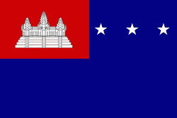
Country - Khmer_Republic
 |
 |
| Flag of Cambodia | |
The main cause of the coup was Norodom Sihanouk's tolerance of North Vietnamese military activity within Cambodia's borders; Vietnamese communist forces had gained de facto control over vast areas of eastern Cambodia as a result. Another important factor was the dire state of the Cambodian economy, an indirect result of Sihanouk's policies of pursuing neutrality.
Currency / Language
| ISO | Currency | Symbol | Significant figures |
|---|---|---|---|
| KHR | Cambodian riel | ៛ | 2 |
| ISO | Language |
|---|---|
| KM | Central Khmer language |
| EN | English language |
| FR | French language |